
Understanding Satellite Systems and the Complexity of data Processing Chains
Motivation and Scope
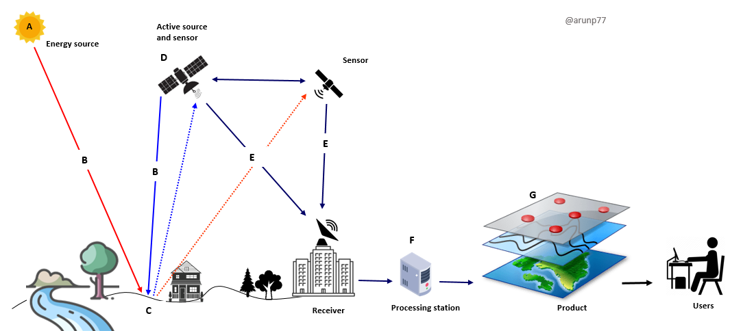
Satellite data products are the result of a long and carefully structured processing chain, transforming raw instrument signals into geophysically meaningful quantities. Understanding this chain is essential for correct interpretation of satellite-derived information, especially in climate and environmental applications where small biases and long-term stability matter.
Sea Surface Temperature (SST) is chosen as a representative example because it combines relatively well-understood physical principles with a high level of practical relevance. SST has been observed from space for several decades, is produced operationally by multiple satellite missions, and is widely used in weather prediction, oceanography, and climate studies. At the same time, SST retrieval highlights many of the key challenges common to satellite data processing, including calibration stability, atmospheric correction, model dependence, and uncertainty propagation.
The scope of this example is deliberately limited. The discussion does not aim to describe mission-specific implementations, sensor-dependent tuning, or operational software details. Nor does it attempt to optimise or validate a particular SST algorithm. Instead, the focus is on explaining the logical structure of the processing chain, from measurement to higher-level products, and on clarifying how physical assumptions and mathematical transformations enter at each stage.
This example is intended for readers with a basic technical background who seek a conceptual and quantitative understanding of satellite data processing, rather than a step-by-step guide to code implementation. The emphasis is on measurement principles, processing logic, and interpretation, rather than on programming or system engineering.
The purpose of this document is to open that box.
Reference
- Fundamentals of Remote sensing
- Relevance of Electromagnetic waves in the context of earth observation
- Concept of the orbits for a satellite (non scientific discussion)
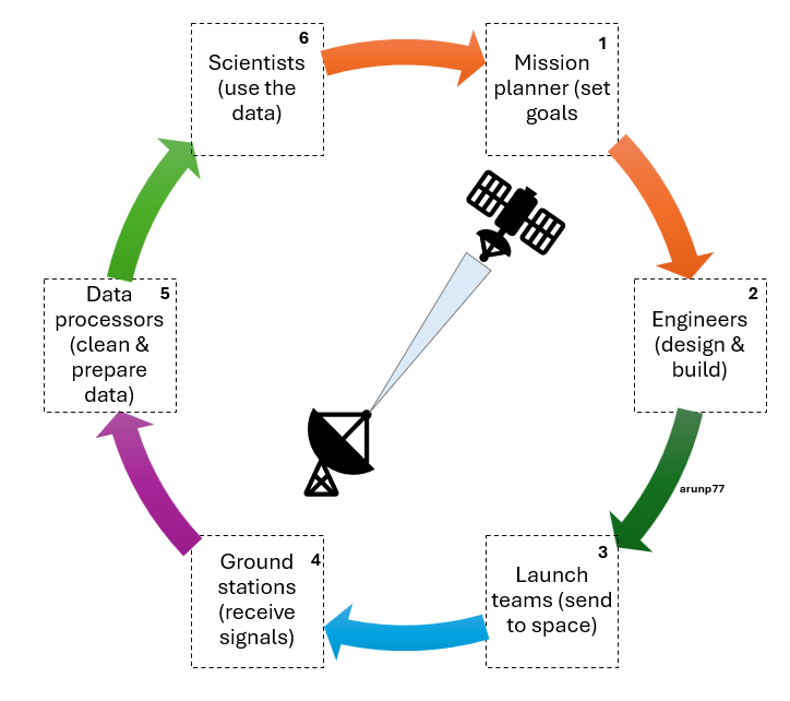
- How various teams works in close collaboration for the ground data processing?
- How raw satellite data is processed to do a level where you do your scientifc research?
- In depth understandingof the satellite data (op-of-atmosphere reflectance)
- Resolution and calibration
- Understanding how OLCI data is processed
- Transforming Energy into Imagery: How Satellite Data Becomes Stunning Views of Earth